
Say goodbye to static, paper-based alignment charts. Benefit from smarter, faster decisions.
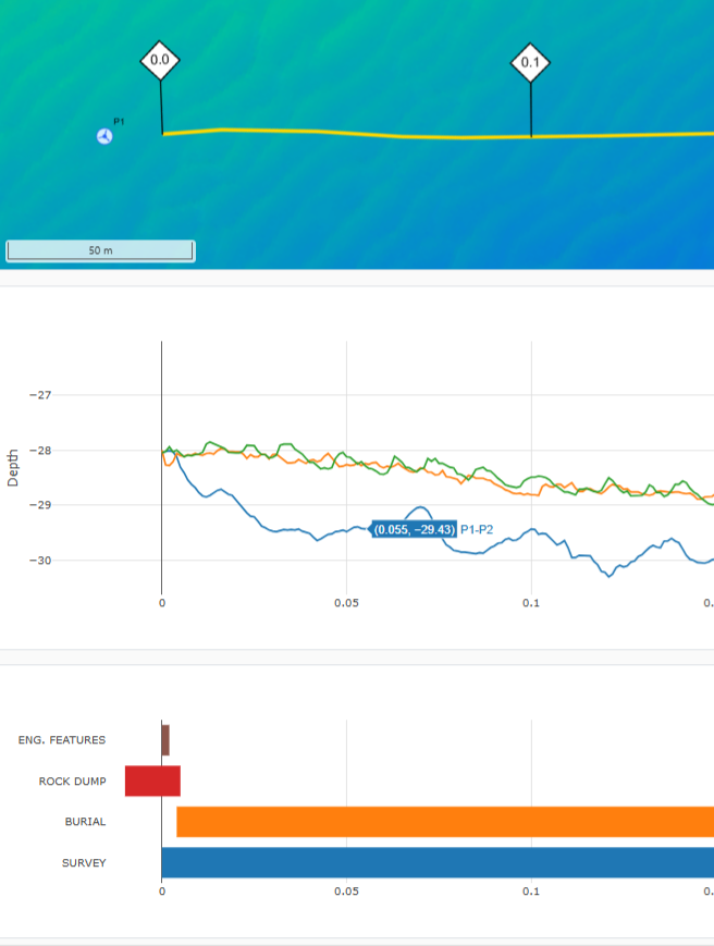
GRIDit ALIGN reinvents alignment charts as interactive, digital tools. Through intuitive and flexible use of past, present and future data, GRIDit ALIGN maximises the efficiency of offshore operations.
- Instantly produce high quality, printable alignment charts.
- Scroll, edit and compare datasets.
- Monitor the status of subsea assets and compare changes over time.
- Visualise changes to the seabed, exposures, and the effect of mitigations like rock dumps.
- Improve collaboration and reporting efficiency.
GRIDit has established its position as a leading subsea data management platform. It is widely used by offshore operators across northwest Europe, including by offshore wind, CCS, dredging, survey and hydrocarbon sectors. Produced by subsea data experts for offshore operators, the GRIDit ALIGN module has been designed for operators who need more from their alignment charts.
For more information see www.gridit.nl/align.
To book a demo, contact info@gridit.nl