
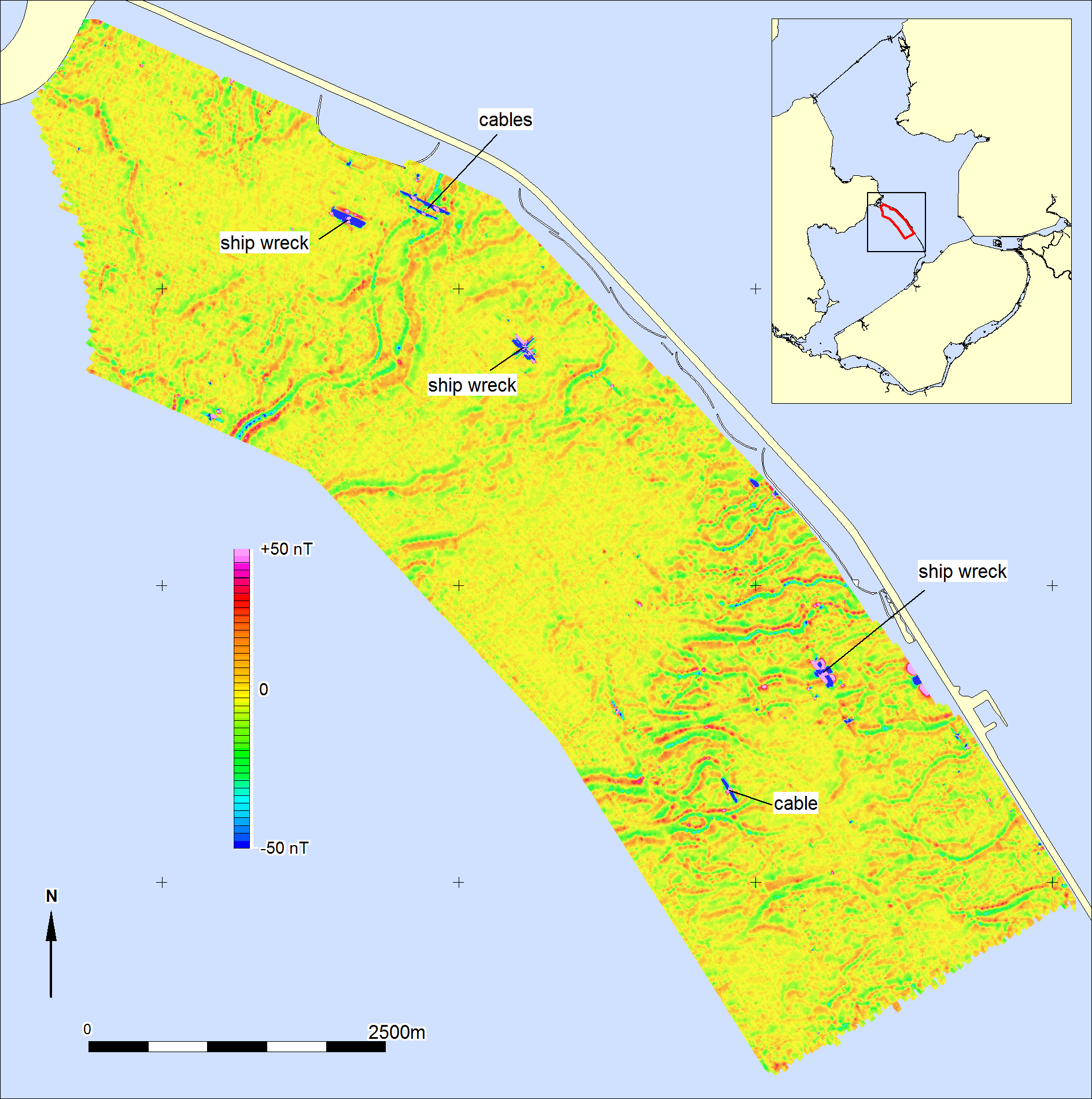
Several historic shipwrecks were found in the area with side scan sonar and magnetometer. Remarkably, the interpolated magnetometer image showed a clear pattern of linear structures that could not be related to cables or pipelines. Further research has shown that the pattern is caused by the presence of buried prehistoric channels. The channels themselves are filled with sand, while the banks consist mainly of clay. The iron-containing minerals in the clay cause the deviations in the magnetic image. Similar studies in the IJsselmeer area show the same results. This methodology can make an important contribution to the mapping of shallow geology in the future, for example in the construction of wind farm zones.
Magnetic anomalies reveal prehistoric channels
Covered prehistoric trenches made visible with magnetometer. In cooperation with DEEP survey, Periplus Archeomare conducted an archaeological survey for an area south of the Houtribdijk in the Markermeer.